![]()
![]()
HRU discretization
This notebook describes hru discretization for any catchment using shapefiles.
[1]:
import os

from ai4water.preprocessing import MakeHRUs
from ai4water.utils.utils import get_version_info
D:\C\Anaconda3\envs\tfcpu27_py39\lib\site-packages\numpy\_distributor_init.py:30: UserWarning: loaded more than 1 DLL from .libs:
D:\C\Anaconda3\envs\tfcpu27_py39\lib\site-packages\numpy\.libs\libopenblas.EL2C6PLE4ZYW3ECEVIV3OXXGRN2NRFM2.gfortran-win_amd64.dll
D:\C\Anaconda3\envs\tfcpu27_py39\lib\site-packages\numpy\.libs\libopenblas.GK7GX5KEQ4F6UYO3P26ULGBQYHGQO7J4.gfortran-win_amd64.dll
  warnings.warn("loaded more than 1 DLL from .libs:"
D:\C\Anaconda3\envs\tfcpu27_py39\lib\site-packages\sklearn\experimental\enable_hist_gradient_boosting.py:16: UserWarning: Since version 1.0, it is not needed to import enable_hist_gradient_boosting anymore. HistGradientBoostingClassifier and HistGradientBoostingRegressor are now stable and can be normally imported from sklearn.ensemble.
  warnings.warn(
[2]:
for lib,ver in get_version_info().items():
    print(lib, ver)  # print versions of the libraries used
python 3.9.7 | packaged by conda-forge | (default, Sep 29 2021, 19:20:16) [MSC v.1916 64 bit (AMD64)]
os nt
ai4water 1.06
lightgbm 3.3.1
tcn 3.4.0
catboost 0.26
xgboost 1.5.0
easy_mpl 0.21.3
SeqMetrics 1.3.3
tensorflow 2.7.0
keras.api._v2.keras 2.7.0
numpy 1.21.0
pandas 1.3.4
matplotlib 3.4.3
h5py 3.5.0
sklearn 1.0.1
shapefile 2.3.0
xarray 0.20.1
netCDF4 1.5.7
optuna 2.10.1
skopt 0.9.0
hyperopt 0.2.7
plotly 5.3.1
lime NotDefined
seaborn 0.11.2
[3]:
shapefile_paths = os.path.join(os.getcwd(), 'shapefiles')
assert os.path.exists(shapefile_paths)
assert len(os.listdir(shapefile_paths))>=35
[4]:
Soil_shp = os.path.join(shapefile_paths, 'soil.shp')

SubBasin_shp = os.path.join(shapefile_paths, 'sub_basins.shp')
slope_shp = os.path.join(shapefile_paths, 'slope.shp')

years = {2011: {'shapefile': os.path.join(shapefile_paths, 'lu2011.shp'), 'feature': 'NAME'},
         2012: {'shapefile': os.path.join(shapefile_paths, 'lu2012.shp'), 'feature': 'NAME'},
         2013: {'shapefile': os.path.join(shapefile_paths, 'lu2013.shp'), 'feature': 'NAME'},
         2014: {'shapefile': os.path.join(shapefile_paths, 'lu2014.shp'), 'feature': 'NAME'},
         # 2015:"D:\\Laos\\data\\landuse\\shapefiles\\LU2015.shp"
         }
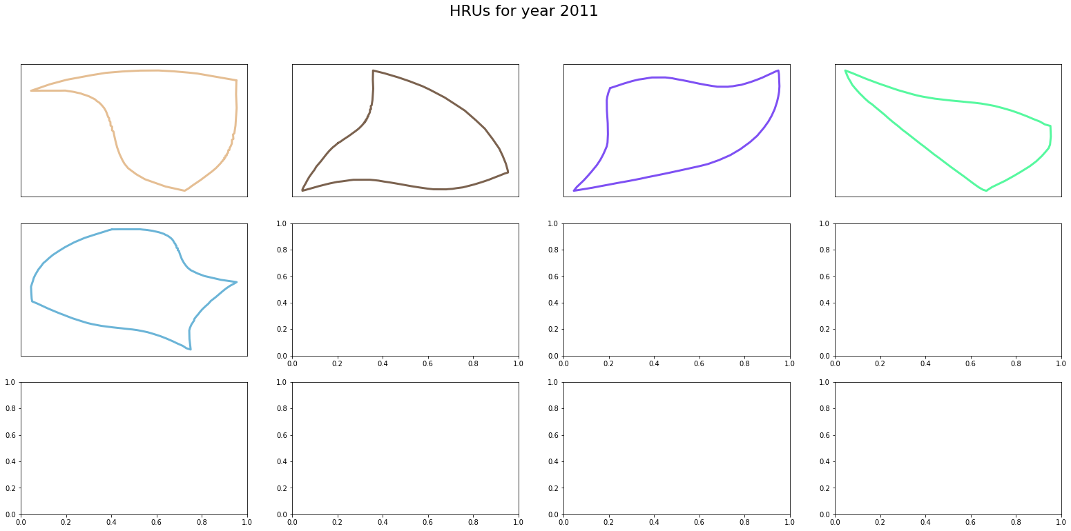
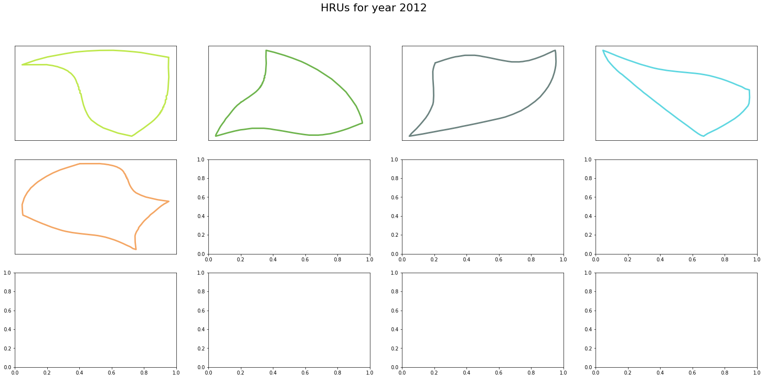
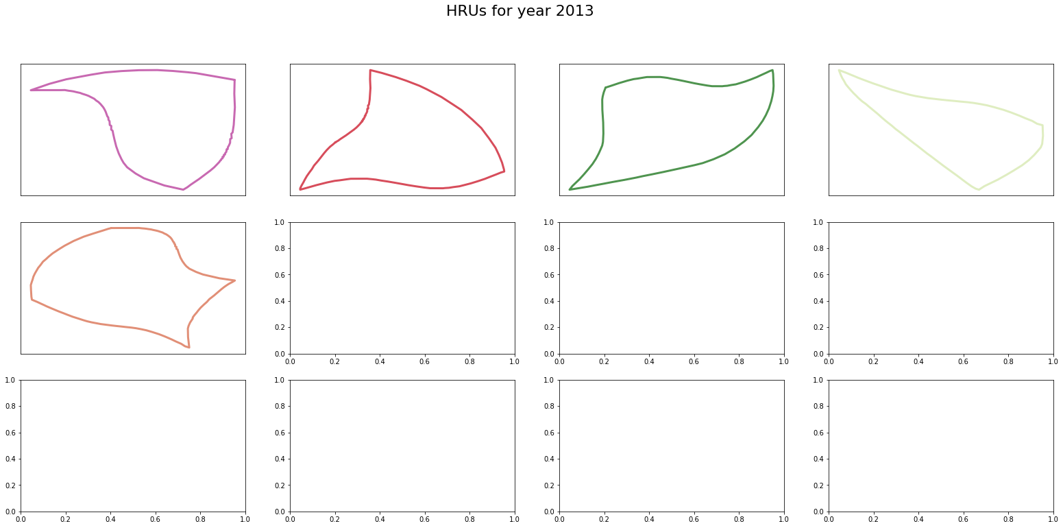
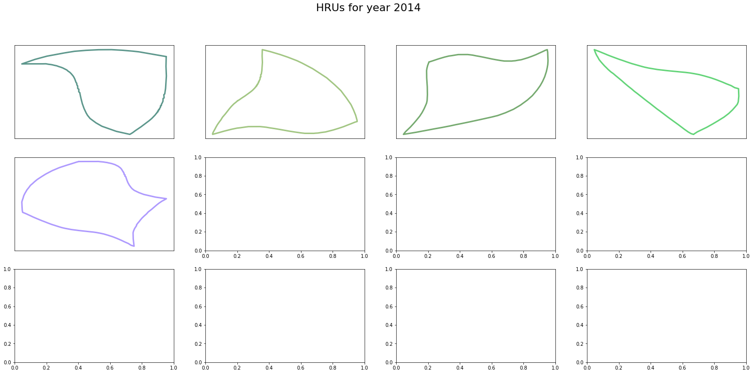
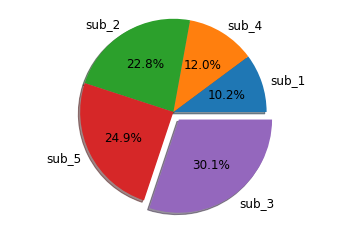
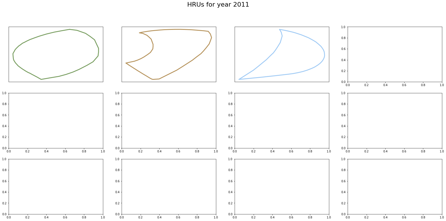
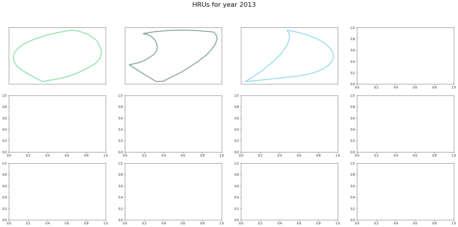
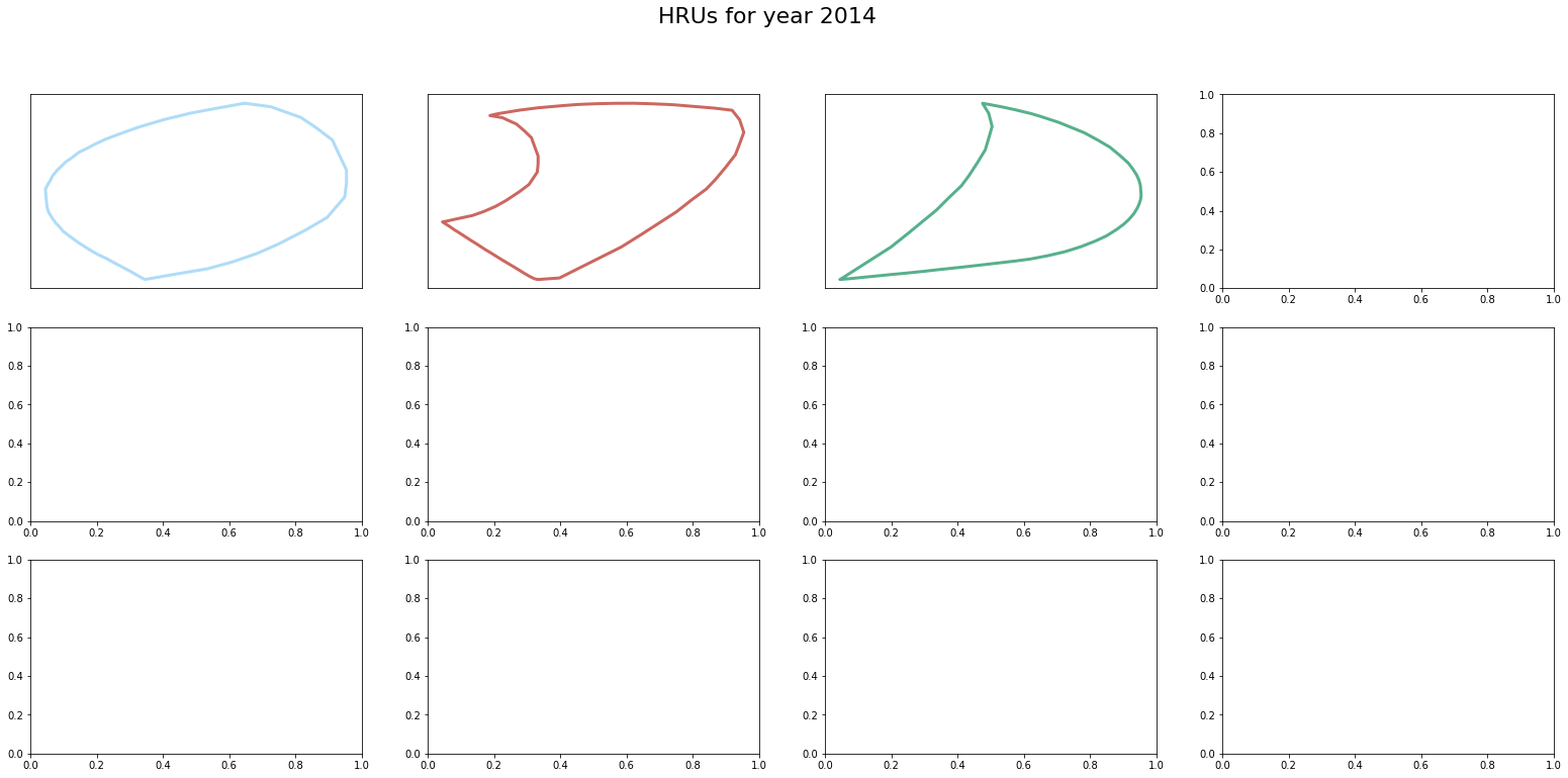
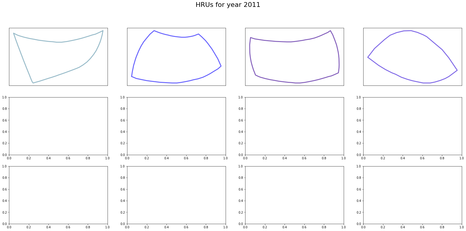
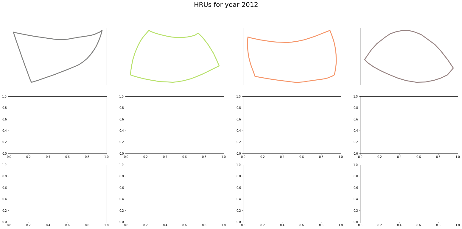
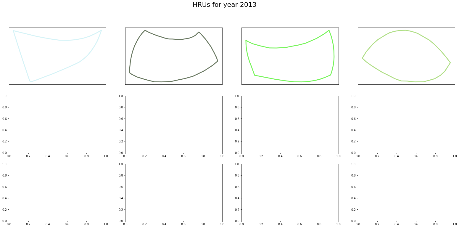
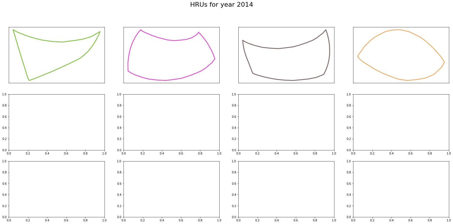
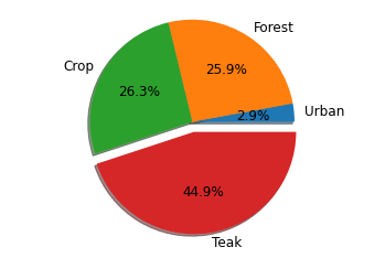
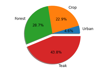
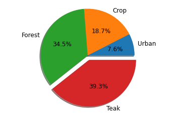
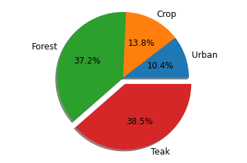
unique_sub
The simplest case, where the HRU is formed by subbaisns.
[5]:
hru_object = MakeHRUs('unique_sub',
                      index={2011: None, 2012: None, 2013:None, 2014:None},
                      subbasins_shape={'shapefile': SubBasin_shp, 'feature': 'id'},
                     )

hru_object.call(plot_hrus=True)
Checking validity of landuse shapefile
Checking validity of landuse shapefile
Checking validity of landuse shapefile
Checking validity of landuse shapefile
[6]:
for yr in years:
    hru_object.draw_pie(yr, title=False, n_merge=0, textprops={'fontsize': '12'})


[7]:
_ = hru_object.plot_as_ts(min_xticks=3, max_xticks=4)
AutoDateLocator was unable to pick an appropriate interval for this date range. It may be necessary to add an interval value to the AutoDateLocator's intervald dictionary. Defaulting to 6.
AutoDateLocator was unable to pick an appropriate interval for this date range. It may be necessary to add an interval value to the AutoDateLocator's intervald dictionary. Defaulting to 6.
AutoDateLocator was unable to pick an appropriate interval for this date range. It may be necessary to add an interval value to the AutoDateLocator's intervald dictionary. Defaulting to 6.
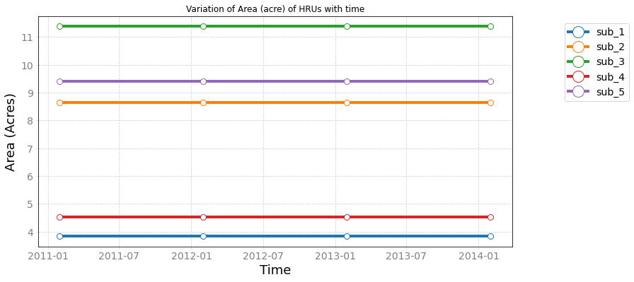
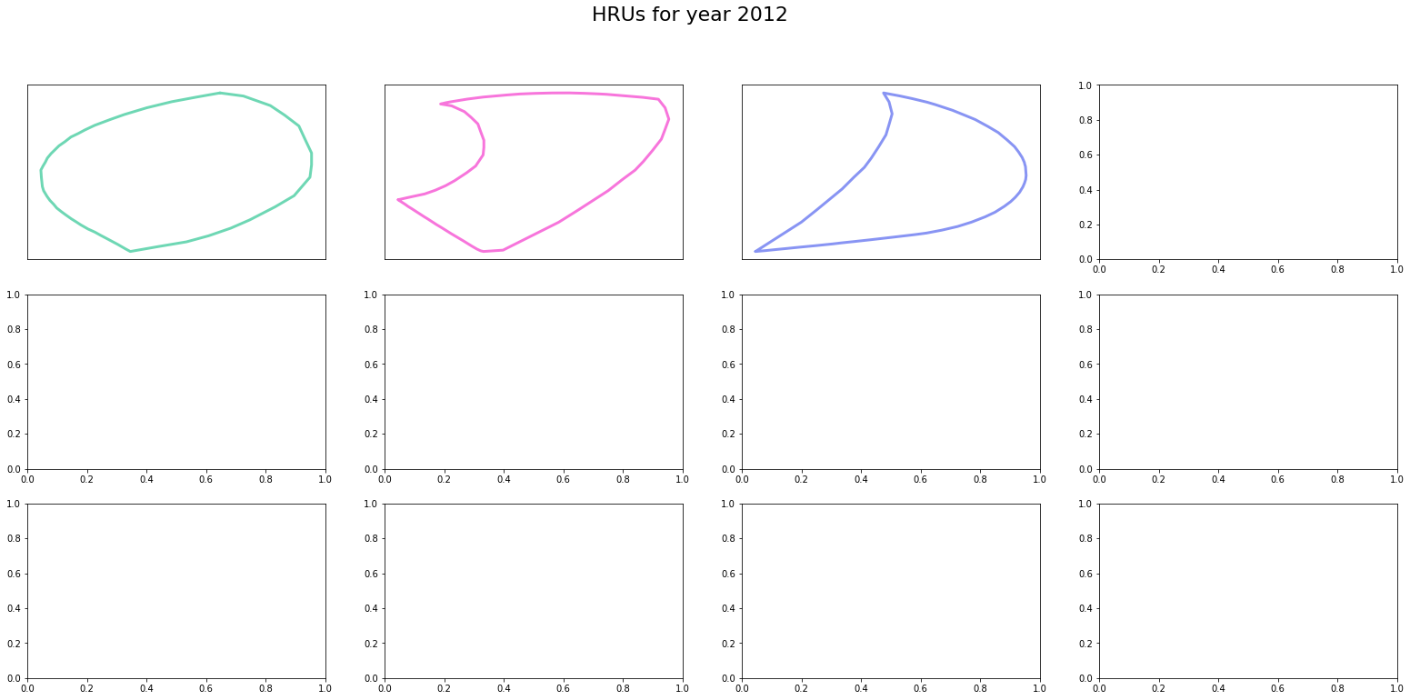
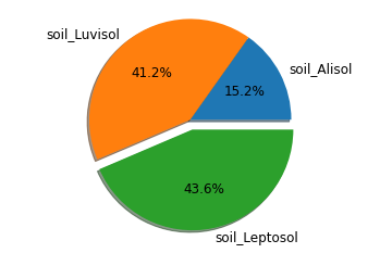
unique_soil
[8]:
hru_object = MakeHRUs('unique_soil',
                      index={2011: None, 2012: None, 2013:None, 2014:None},
                      soil_shape={'shapefile': Soil_shp, 'feature': 'NAME'}
                     )

hru_object.call(plot_hrus=True)
Checking validity of landuse shapefile
soil 0 is valid now
soil 1 is valid now
soil 2 is valid now
Checking validity of landuse shapefile
soil 0 is valid now
soil 1 is valid now
soil 2 is valid now
Checking validity of landuse shapefile
soil 0 is valid now
soil 1 is valid now
soil 2 is valid now
Checking validity of landuse shapefile
soil 0 is valid now
soil 1 is valid now
soil 2 is valid now
[9]:
for yr in years:
    hru_object.draw_pie(yr, title=False, textprops={'fontsize': '12'})


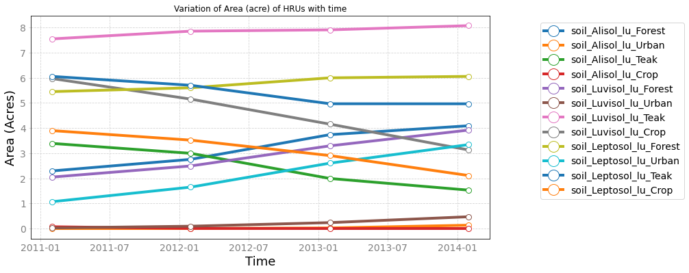
[10]:
hru_object.plot_as_ts(min_xticks=3, max_xticks=4)
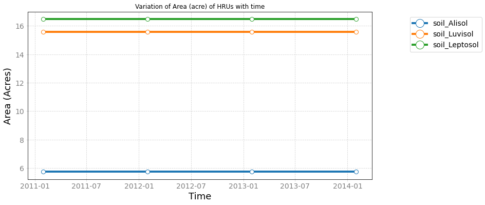
[10]:
<AxesSubplot:title={'center':'Variation of Area (acre) of HRUs with time'}, xlabel='Time', ylabel='Area (Acres)'>
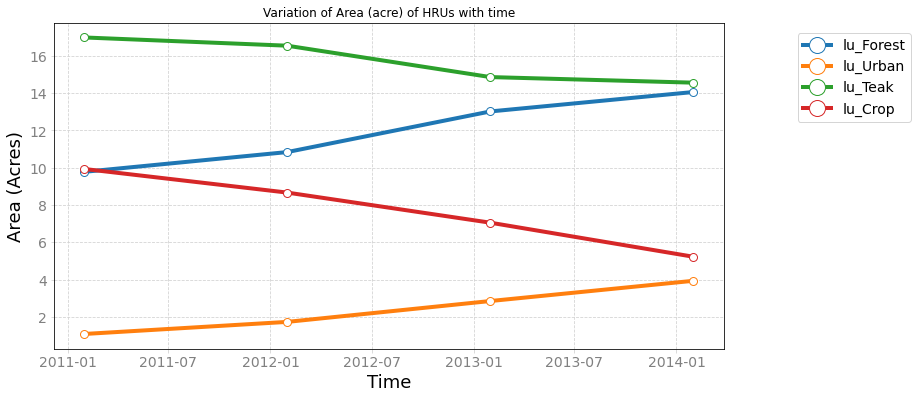
unique_lu
Since the land use varies with time, we will include it in index.
[11]:
hru_object = MakeHRUs('unique_lu',
                      index=years,
                     )

hru_object.call(plot_hrus=True)
Checking validity of landuse shapefile
lu 0 is valid now
lu 1 is valid now
lu 2 is valid now
lu 3 is valid now
Checking validity of landuse shapefile
lu 0 is valid now
lu 1 is valid now
lu 2 is valid now
lu 3 is valid now
Checking validity of landuse shapefile
lu 0 is valid now
lu 1 is valid now
lu 2 is valid now
lu 3 is valid now
Checking validity of landuse shapefile
lu 0 is valid now
lu 1 is valid now
lu 2 is valid now
lu 3 is valid now
[12]:
for yr in years:
    hru_object.draw_pie(yr, title=False, textprops={'fontsize': '12'})
[13]:
_ = hru_object.plot_as_ts(min_xticks=3, max_xticks=4)
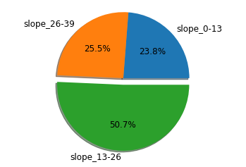
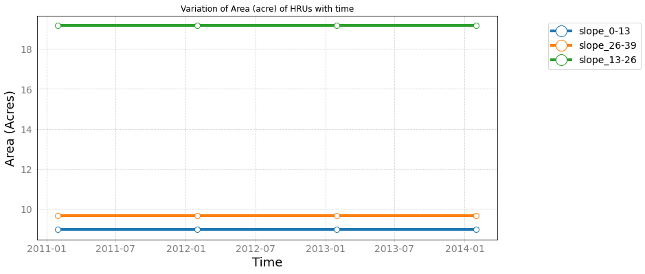
unique_slope
[14]:
hru_object = MakeHRUs('unique_slope',
                      index={2011: None, 2012: None, 2013:None, 2014:None},
                      slope_shape={'shapefile': slope_shp, 'feature': 'percent'}
                     )

hru_object.call(plot_hrus=False)
for yr in years:
    hru_object.draw_pie(yr, title=False, textprops={'fontsize': '12'})
Checking validity of landuse shapefile
slope 0 is valid now
slope 1 is valid now
slope 2 is valid now
Checking validity of landuse shapefile
slope 0 is valid now
slope 1 is valid now
slope 2 is valid now
Checking validity of landuse shapefile
slope 0 is valid now
slope 1 is valid now
slope 2 is valid now
Checking validity of landuse shapefile
slope 0 is valid now
slope 1 is valid now
slope 2 is valid now


[15]:
_ = hru_object.plot_as_ts(min_xticks=3, max_xticks=4)
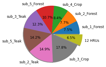
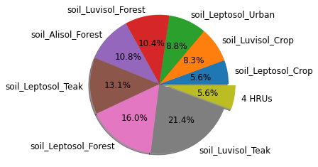
unique_lu_sub
[16]:
hru_object = MakeHRUs('unique_lu_sub',
                      index=years,
                      subbasins_shape={'shapefile': SubBasin_shp, 'feature': 'id'}
                     )

hru_object.call(False)
Checking validity of landuse shapefile
Checking validity of landuse shapefile
Checking validity of landuse shapefile
Checking validity of landuse shapefile
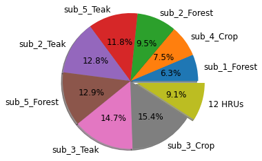
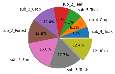
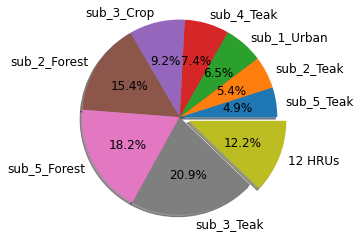
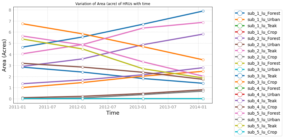
[17]:
for yr in years:
    hru_object.draw_pie(yr, n_merge=12, title=False, textprops={'fontsize': '12'})
[18]:
_ = hru_object.plot_as_ts(min_xticks=3, max_xticks=4)
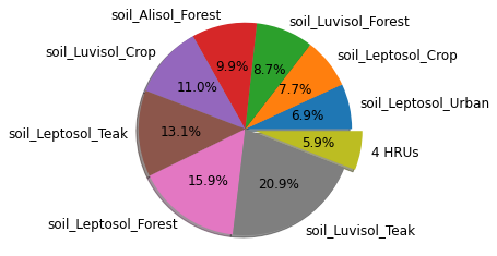
unique_lu_soil
combination of land use and soil
[19]:
hru_object = MakeHRUs('unique_lu_soil',
                      index=years,
                      soil_shape={'shapefile': Soil_shp, 'feature': 'NAME'}
                     )

hru_object.call(False)
Checking validity of landuse shapefile
soil 0 is valid now
soil 1 is valid now
soil 2 is valid now
Checking validity of landuse shapefile
soil 0 is valid now
soil 1 is valid now
soil 2 is valid now
Checking validity of landuse shapefile
soil 0 is valid now
soil 1 is valid now
soil 2 is valid now
Checking validity of landuse shapefile
soil 0 is valid now
soil 1 is valid now
soil 2 is valid now
[20]:
for yr in years:
    hru_object.draw_pie(yr, n_merge=4, title=False, textprops={'fontsize': '12'})
[21]:
_ = hru_object.plot_as_ts(min_xticks=3, max_xticks=4)
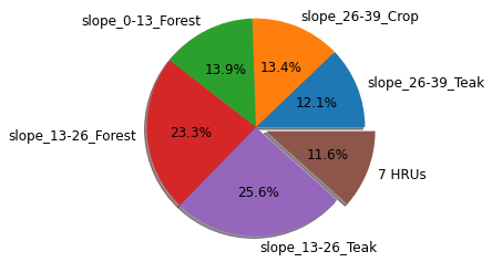
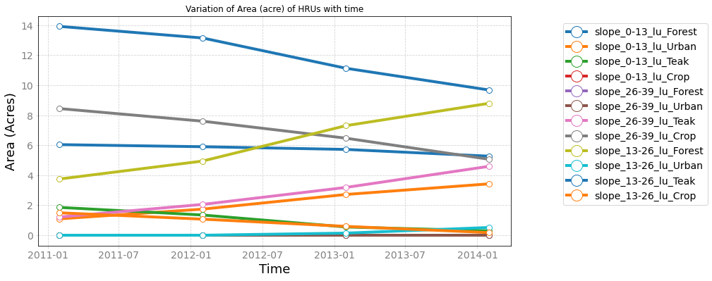
unique_lu_slope
[22]:
hru_object = MakeHRUs('unique_lu_slope',
                      index=years,
                      slope_shape={'shapefile': slope_shp, 'feature': 'percent'}
                     )

hru_object.call(False)
Checking validity of landuse shapefile
slope 0 is valid now
slope 1 is valid now
slope 2 is valid now
Checking validity of landuse shapefile
slope 0 is valid now
slope 1 is valid now
slope 2 is valid now
Checking validity of landuse shapefile
slope 0 is valid now
slope 1 is valid now
slope 2 is valid now
Checking validity of landuse shapefile
slope 0 is valid now
slope 1 is valid now
slope 2 is valid now
[23]:
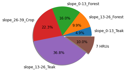
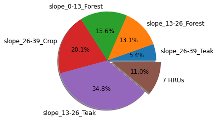
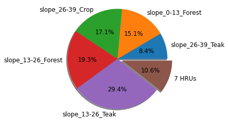
for yr in years:
    hru_object.draw_pie(yr, n_merge=7, title=False, textprops={'fontsize': '12'})
[24]:
_ = hru_object.plot_as_ts(min_xticks=3, max_xticks=4)
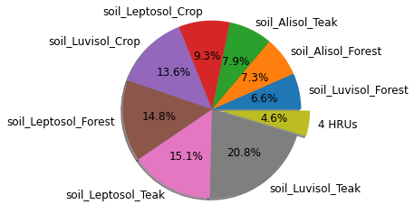
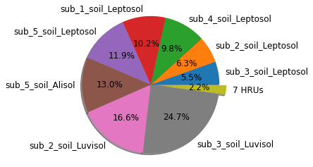
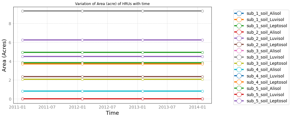
unique_soil_sub
combination of soil type and sub-basin
[25]:
hru_object = MakeHRUs('unique_soil_sub',
                      index={2011: None, 2012: None, 2013:None, 2014:None},
                      subbasins_shape={'shapefile': SubBasin_shp, 'feature': 'id'},
                      soil_shape={'shapefile': Soil_shp, 'feature': 'NAME'}
                     )

hru_object.call(False)
Checking validity of landuse shapefile
Checking validity of landuse shapefile
Checking validity of landuse shapefile
Checking validity of landuse shapefile
[26]:
for yr in years:
    hru_object.draw_pie(yr, n_merge=7, title=False, textprops={'fontsize': '12'})


[27]:
_ = hru_object.plot_as_ts(min_xticks=3, max_xticks=4)
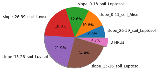
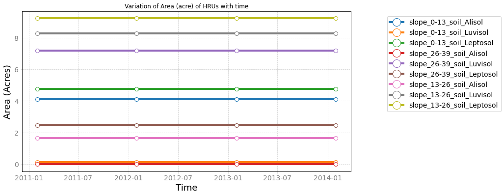
unique_soil_slope
combination of soil types and slope categories
[28]:
hru_object = MakeHRUs('unique_soil_slope',
                      index={2011: None, 2012: None, 2013:None, 2014:None},
                      slope_shape={'shapefile': slope_shp, 'feature': 'percent'},
                      soil_shape={'shapefile': Soil_shp, 'feature': 'NAME'}
                     )

hru_object.call(False)
Checking validity of landuse shapefile
slope 0 is valid now
slope 1 is valid now
slope 2 is valid now
Checking validity of landuse shapefile
slope 0 is valid now
slope 1 is valid now
slope 2 is valid now
Checking validity of landuse shapefile
slope 0 is valid now
slope 1 is valid now
slope 2 is valid now
Checking validity of landuse shapefile
slope 0 is valid now
slope 1 is valid now
slope 2 is valid now
[29]:
for yr in years:
    hru_object.draw_pie(yr, n_merge=3, title=False, textprops={'fontsize': '12'})


[30]:
_ = hru_object.plot_as_ts(min_xticks=3, max_xticks=4)
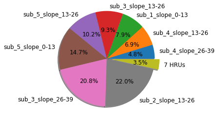
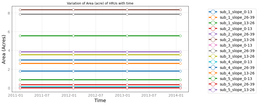
unique_slope_sub
combination of slope categories and sub-basins
[31]:
hru_object = MakeHRUs('unique_slope_sub',
                      index={2011: None, 2012: None, 2013:None, 2014:None},
                      slope_shape={'shapefile': slope_shp, 'feature': 'percent'},
                      subbasins_shape={'shapefile': SubBasin_shp, 'feature': 'id'}
                     )

hru_object.call(False)
Checking validity of landuse shapefile
Checking validity of landuse shapefile
Checking validity of landuse shapefile
Checking validity of landuse shapefile
[32]:
for yr in years:
    hru_object.draw_pie(yr, n_merge=7, title=False, textprops={'fontsize': '12'})


[33]:
_ = hru_object.plot_as_ts(min_xticks=3, max_xticks=4)
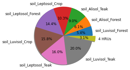
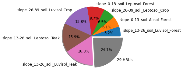
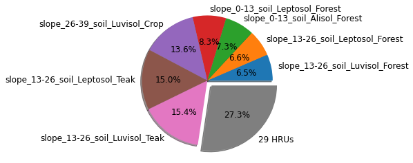
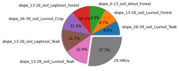
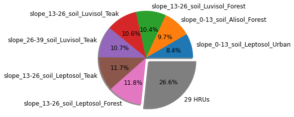
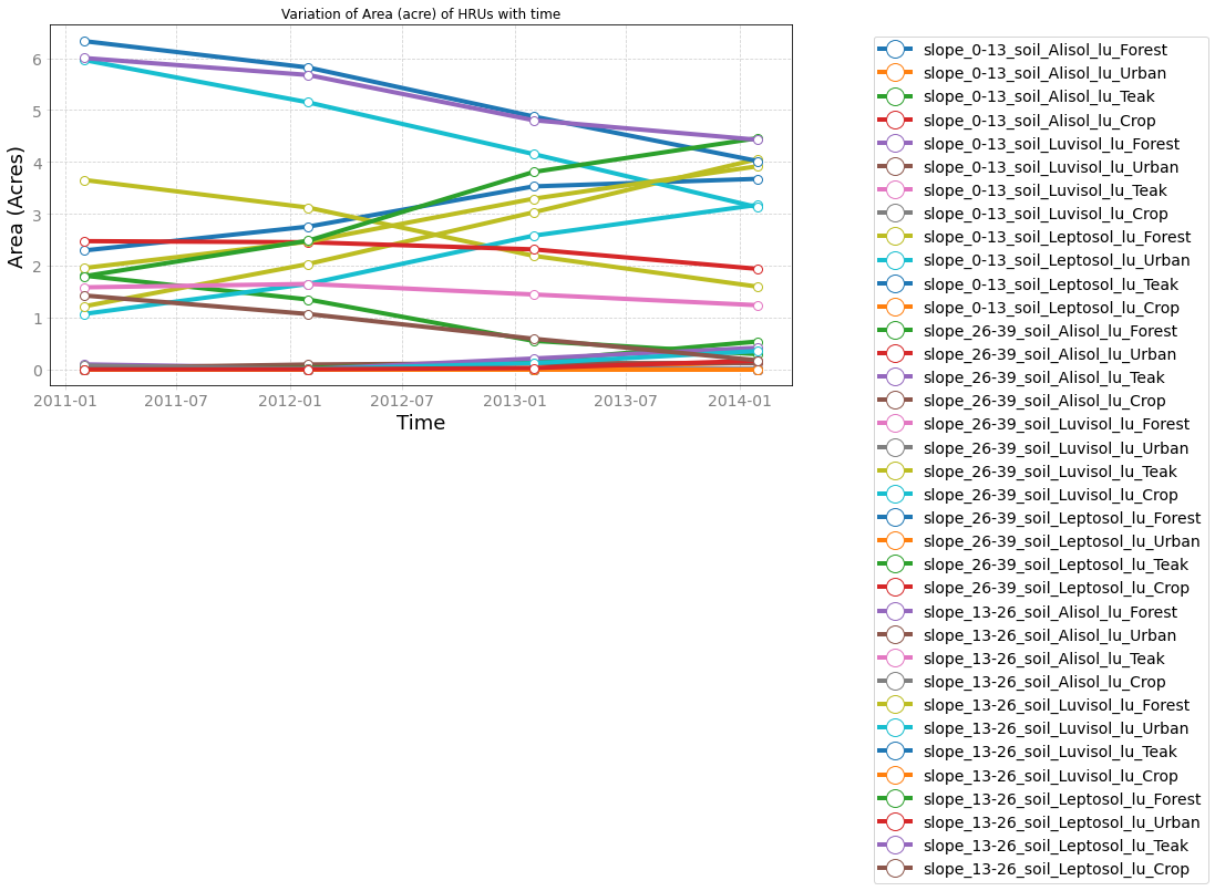
unique_lu_soil_slope
combination of land use, soil and slope.
[34]:
hru_object = MakeHRUs('unique_lu_soil_slope',
                      index=years,
                      slope_shape={'shapefile': slope_shp, 'feature': 'percent'},
                      soil_shape={'shapefile': Soil_shp, 'feature': 'NAME'},
                     )

hru_object.call(False)
Checking validity of landuse shapefile
soil 0 is valid now
soil 1 is valid now
soil 2 is valid now
Checking validity of landuse shapefile
soil 0 is valid now
soil 1 is valid now
soil 2 is valid now
Checking validity of landuse shapefile
soil 0 is valid now
soil 1 is valid now
soil 2 is valid now
Checking validity of landuse shapefile
soil 0 is valid now
soil 1 is valid now
soil 2 is valid now
[35]:
for yr in years:
    hru_object.draw_pie(yr, n_merge=29, title=False, textprops={'fontsize': '12'})
[36]:
_ = hru_object.plot_as_ts(min_xticks=3, max_xticks=4)
[ ]: